
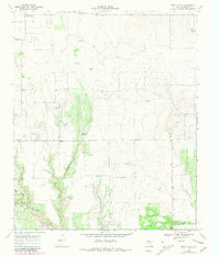
1968 Map of East Afton
USGS Topo · Published 1970About this map
East Afton and the small settlement of Croton anchor this 1968 survey of the Texas Rolling Plains. The landscape is defined by the headwaters of the South Wichita River and the winding course of Little Croton Creek, which are fed by numerous seasonal drainages like Beef Hollow and Washout Creek. Local infrastructure is marked by a network of ranch roads and specialized water sources including Duncan Tank and Wichita Tank, essential for livestock in this arid environment. The map captures the area as a working landscape, documented through numerous Gravel Pits and various Well and Wells sites scattered across the plains. This topographic study, based on 1966 aerial photography and 1968 field checks, provides a clear record of land use and property boundaries, indicated by fine red dashed lines representing selected fence lines across the Riley terrain.
Find a feature on this map
13 named features on this map. Tap any name to fly to it.
Don’t see what you’re looking for? This feature index may not catch every label — zoom into the map to look around manually.
Map Details
Editions of this 1968 East Afton Map
2 editions found
Other maps of this area

1954 · Lubbock
USGS Topo · 1:250,000

1967 · Dickens North
USGS Topo · 1:24,000

1967 · Dickens South
USGS Topo · 1:24,000

1968 · Pitchfork Ranch
USGS Topo · 1:24,000

1968 · Dumont
USGS Topo · 1:24,000

1968 · Croton Camp
USGS Topo · 1:24,000

1968 · East Afton NE
USGS Topo · 1:24,000

1968 · Sanders Hollow
USGS Topo · 1:24,000

1968 · Afton
USGS Topo · 1:24,000

1985 · Dickens
USGS Topo · 1:100,000