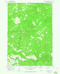
1964 Map of East Basin Creek
USGS Topo · Published 1965About this map
The Salmon River cuts through the southern reaches of this mountain landscape in Challis National Forest, serving as a primary corridor for travel and recreation in the mid-1960s. Along the river's winding path, several public sites including Riverside Campground, Mormon Bend Campground, and Basin Creek Campground line the valley floor. High above the river, the terrain is defined by steep ridges and drainages like East Basin Creek and Deadwood Creek. Evidence of local industry is sparse but present, marked by a single Mine accessed by a Jeep Trail in the central highlands. Higher elevations features include the peak of McGowan and the remote East Basin Lake, while the northeastern corner shows the confluence of West Fork Yankee Fork and West Fork Campground.
Find a feature on this map
31 named features on this map. Tap any name to fly to it.
Don’t see what you’re looking for? This feature index may not catch every label — zoom into the map to look around manually.
Map Details
Editions of this 1964 East Basin Creek Map
2 editions found
Other maps of this area

1919 · Custer
USGS Topo · 1:125,000

1922 · Custer
USGS Topo · 1:125,000

1957 · Challis
USGS Topo · 1:250,000

1960 · Challis
USGS Topo · 1:250,000

1963 · Challis
USGS Topo · 1:250,000

1963 · Custer
USGS Topo · 1:24,000

1963 · Stanley
USGS Topo · 1:24,000

1963 · Basin Butte
USGS Topo · 1:24,000

1963 · Casino Lakes
USGS Topo · 1:24,000
1964 · Knapp Lakes
USGS Topo · 1:24,000