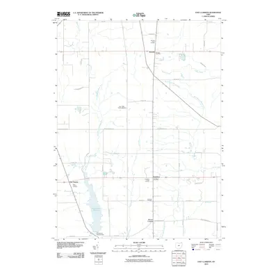
2010 Map of East Claridon
USGS Topo · Published 2010About this map
East Branch Reservoir dominates the southwestern landscape of this Geauga County region, created by the East Branch Reservoir Dam to manage the headwaters of the East Branch Cuyahoga River. The map illustrates a rural Ohio landscape defined by small crossroads settlements and agricultural grid patterns. At Montville, East Claridon, and Huntsburg, the layout of 21st-century civic life is visible through local post offices and numerous historic burial grounds, such as Montville Center Cemetery and East Claridon Cemetery. The drainage network is particularly detailed, showing the intricate split between Phelps Creek and its various branches as they move east, contrasted by the private Bod Ricks Airfield Airport and the pocket of recreational water at Spring Lake.
Find a feature on this map
44 named features on this map. Tap any name to fly to it.
Don’t see what you’re looking for? This feature index may not catch every label — zoom into the map to look around manually.
Map Details
Editions of this 2010 East Claridon Map
This is the sole edition of this map. No revisions or reprints were ever made.
Other maps of this area

1904 · Chardon
USGS Topo · 1:62,500

1905 · Bristolville
USGS Topo · 1:62,500

1905 · Garrettsville
USGS Topo · 1:62,500

1905 · Jefferson
USGS Topo · 1:62,500

1906 · Chardon
USGS Topo · 1:62,500

1907 · Bristolville
USGS Topo · 1:62,500

1907 · Jefferson
USGS Topo · 1:62,500

1907 · Garrettsville
USGS Topo · 1:62,500

1950 · Cleveland
USGS Topo · 1:250,000

1952 · West Farmington
USGS Topo · 1:24,000
Featured Places
- Hambden Township, OH
- Mesopotamia Township, OH
- Burton Township, OH
- Hartsgrove Township, OH
- Windsor Township, OH