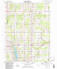
1994 Map of East Claridon
USGS Topo · Published 1997About this map
The East Branch Reservoir dominates the southwestern quadrant of this Geauga County landscape, serving as a primary hydrologic anchor for the surrounding rural townships. The Cuyahoga River and its various branches, including the East Branch Cuyahoga River, meander through a patchwork of woodlots and agricultural fields. Human settlement is concentrated in the crossroad communities of Montville, Huntsburg, and East Claridon, where local institutions like the Huntsburg Sch and Huntsburg Cem suggest long-standing community roots.
Find a feature on this map
45 named features on this map. Tap any name to fly to it.
Don’t see what you’re looking for? This feature index may not catch every label — zoom into the map to look around manually.
Map Details
Editions of this 1994 East Claridon Map
This is the sole edition of this map. No revisions or reprints were ever made.
Other maps of this area

1904 · Chardon
USGS Topo · 1:62,500

1905 · Bristolville
USGS Topo · 1:62,500

1905 · Garrettsville
USGS Topo · 1:62,500

1905 · Jefferson
USGS Topo · 1:62,500

1906 · Chardon
USGS Topo · 1:62,500

1907 · Bristolville
USGS Topo · 1:62,500

1907 · Jefferson
USGS Topo · 1:62,500

1907 · Garrettsville
USGS Topo · 1:62,500

1950 · Cleveland
USGS Topo · 1:250,000

1952 · West Farmington
USGS Topo · 1:24,000
Featured Places
- Hambden Township, OH
- Mesopotamia Township, OH
- Burton Township, OH
- Hartsgrove Township, OH
- East Claridon, Claridon Township