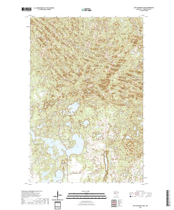
2022 Map of East Crooked Lake
USGS Topo · Published 2022About this map
East Crooked Lake and Waboose Lake anchor this Hubbard County landscape, where the glacial geography of Minnesota's northern woods is crisscrossed by an extensive network of modern recreational and forest roads. The terrain is defined by its numerous water bodies, including Crooked Lake, Coon Lake, and Crow Wing Lake, which are linked by winding paths like the Round River Drive Trl and the Martineau Recreational Trails Trl. The presence of the North Country National Scenic Trl cutting through the northern sections emphasizes the area's role as a contemporary outdoor destination. Many routes, such as Steamboat Forest Rd and Thorpe Tower Forest Rd, hint at the historic and ongoing importance of timber management in these townships. Settlement patterns are concentrated along arterial routes like Co Hwy 2 and Hubbard Co Rd 85, where smaller residential clusters and drives like Washboard Rd and Heritage Rd have developed near the lakefronts.
Find a feature on this map
42 named features on this map. Tap any name to fly to it.
Don’t see what you’re looking for? This feature index may not catch every label — zoom into the map to look around manually.
Map Details
Editions of this 2022 East Crooked Lake Map
This is the sole edition of this map. No revisions or reprints were ever made.
Other maps of this area

1953 · Brainerd
USGS Topo · 1:250,000

1954 · Bemidji
USGS Topo · 1:250,000

1957 · Brainerd
USGS Topo · 1:250,000

1957 · Bemidji
USGS Topo · 1:250,000

1958 · Bemidji
USGS Topo · 1:250,000

1958 · Brainerd
USGS Topo · 1:250,000

1965 · Brainerd
USGS Topo · 1:250,000

1970 · Nevis
USGS Topo · 1:24,000

1970 · Dorset
USGS Topo · 1:24,000
1970 · Crystal Lake
USGS Topo · 1:24,000