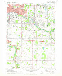
1970 Map of East Lansing
USGS Topo · Published 1973About this map
Michigan State University anchors the western edge of this 1970 landscape, where the campus meets the burgeoning residential developments of East Lansing and Okemos. The Red Cedar River meanders through the center of the sheet, tracing a path past the River-Bend Cem and the Indian Hills Golf Course. This era shows the transition of Meridian and Alaiedon townships from agricultural tracts to suburban communities, yet legacy rural markers remain prominent, including the Leek Cems and various district schools like Kinawa Sch and Wardcliff Sch.
Find a feature on this map
53 named features on this map. Tap any name to fly to it.
Don’t see what you’re looking for? This feature index may not catch every label — zoom into the map to look around manually.
Map Details
Editions of this 1970 East Lansing Map
3 editions found
Other maps of this area

1909 · Mason
USGS Topo · 1:62,500

1910 · Lansing
USGS Topo · 1:62,500

1911 · Mason
USGS Topo · 1:62,500

1912 · Lansing
USGS Topo · 1:62,500

1927 · De Witt
USGS Topo · 1:62,500

1928 · Laingsburg
USGS Topo · 1:62,500

1944 · Laingsburg
USGS Topo · 1:62,500

1958 · Grand Rapids
USGS Topo · 1:250,000

1961 · Grand Rapids
USGS Topo · 1:250,000

1962 · Grand Rapids
USGS Topo · 1:250,000
Featured Places
- Lansing, MI
- East Lansing, MI
- Lansing Charter Township, MI
- Meridian Charter Township, MI
- Delhi Charter Township, MI