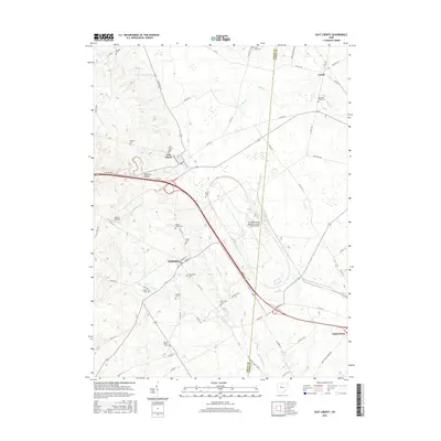
2016 Map of East Liberty
USGS Topo · Published 2016About this map
East Liberty and the surrounding townships in Union County and Logan County are defined by the convergence of the Big Darby Cr and Little Darby Cr headwaters. This agricultural landscape is dotted with small-town hubs like Middleburg and Pottersburg, connected by a network of county and township roads such as Co HWY 347 and Stokes Rd. The presence of the Transportation Research Center of Ohio Airport signals the modern industrial character that contrasts with the area's rural roots.
Find a feature on this map
69 named features on this map. Tap any name to fly to it.
Don’t see what you’re looking for? This feature index may not catch every label — zoom into the map to look around manually.
Map Details
Editions of this 2016 East Liberty Map
This is the sole edition of this map. No revisions or reprints were ever made.
Other maps of this area

1913 · East Liberty
USGS Topo · 1:62,500

1913 · Richwood
USGS Topo · 1:62,500

1914 · Mechanicsburg
USGS Topo · 1:62,500

1915 · Richwood
USGS Topo · 1:62,500

1915 · East Liberty
USGS Topo · 1:62,500

1916 · Mechanicsburg
USGS Topo · 1:62,500

1916 · Milford Center
USGS Topo · 1:62,500

1944 · East Liberty
USGS Topo · 1:62,500

1944 · Mechanicsburg
USGS Topo · 1:62,500

1944 · Richwood
USGS Topo · 1:62,500