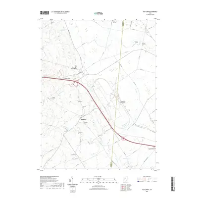
2019 Map of East Liberty
USGS Topo · Published 2019About this map
Middleburg and East Liberty anchor this 2019 survey of the rural landscape where Logan and Union Counties meet. The terrain is defined by the headwaters of several prominent regional waterways, including Big Darby Cr and Little Darby Cr, which carve through the Marmon Valley. A high concentration of family and community burial grounds, such as New Mill Creek Cem, Quaker Cem, and Inskeep Cem, suggests a long-settled agricultural history. While the area maintains its rural character, modern industrial development is evident at the extensive Transportation Research Center of Ohio Airport. This modern map also records smaller, localized landmarks like Oakhaus Landing and the Hillview Airstrip, alongside established crossroads like Lunda and Pottersburg.
Find a feature on this map
70 named features on this map. Tap any name to fly to it.
Don’t see what you’re looking for? This feature index may not catch every label — zoom into the map to look around manually.
Map Details
Editions of this 2019 East Liberty Map
This is the sole edition of this map. No revisions or reprints were ever made.
Other maps of this area

1913 · East Liberty
USGS Topo · 1:62,500

1913 · Richwood
USGS Topo · 1:62,500

1914 · Mechanicsburg
USGS Topo · 1:62,500

1915 · Richwood
USGS Topo · 1:62,500

1915 · East Liberty
USGS Topo · 1:62,500

1916 · Mechanicsburg
USGS Topo · 1:62,500

1916 · Milford Center
USGS Topo · 1:62,500

1944 · East Liberty
USGS Topo · 1:62,500

1944 · Mechanicsburg
USGS Topo · 1:62,500

1944 · Richwood
USGS Topo · 1:62,500