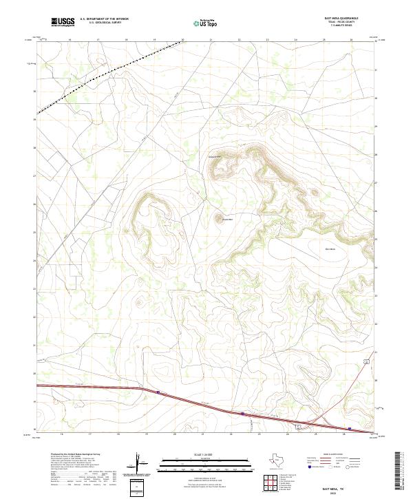
2022 Map of East Mesa
USGS Topo · Published 2022About this map
Guayule Mtn and Round Mtn anchor this high-desert landscape in Pecos County, where the topography rises sharply toward the prominent East Mesa. The map captures a modern industrial and transportation network defined by the long straightaways of Gulf Rd and the regional thoroughfare of FM 2037. These roads cut across the scrubland, connecting the isolated peaks and plateaus to the heavy transit corridor in the south. The southern edge of the quadrangle is dominated by the intersection of University Rd and the extensive frontage systems of 110 Svc Rd, reflecting the modern infrastructure that supports the region's energy and ranching sectors. Local transit is further documented through named tracks like Streul Rd, providing a clear view of how these high-elevation features are navigated today.
Find a feature on this map
8 named features on this map. Tap any name to fly to it.
Don’t see what you’re looking for? This feature index may not catch every label — zoom into the map to look around manually.
Map Details
Editions of this 2022 East Mesa Map
This is the sole edition of this map. No revisions or reprints were ever made.
Other maps of this area

1921 · Fort Stockton
USGS Topo · 1:62,500

1923 · Fort Stockton
USGS Topo · 1:62,500

1928 · Comanche Spring
USGS Topo · 1:125,000

1954 · Pecos
USGS Topo · 1:250,000

1954 · Fort Stockton
USGS Topo · 1:250,000

1957 · Pecos
USGS Topo · 1:250,000

1958 · Fort Stockton
USGS Topo · 1:250,000

1970 · East Mesa
USGS Topo · 1:24,000
1970 · Saddle Butte
USGS Topo · 1:24,000
1970 · Panther Bluff
USGS Topo · 1:24,000