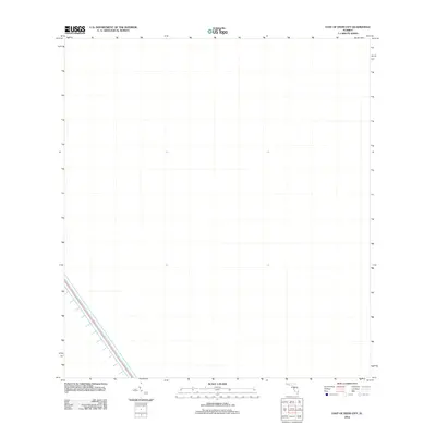
2012 Map of East of Deem City
USGS Topo · Published 2012About this map
North New River Canal cuts a diagonal course across the southwest corner of this landscape, representing a significant piece of the regional water management infrastructure in Broward County. This portion of the North New River Canal is part of the historic drainage system designed to manage water levels across the Florida Everglades. Outside of this major waterway, the area is characterized by an open, undeveloped expanse that highlights the scale of the state's conservation and water conservation areas during the early twenty-first century. The stark contrast between the engineered canal and the surrounding terrain illustrates the ongoing efforts to balance environmental preservation with the hydraulic requirements of South Florida's coastal development.
Find a feature on this map
1 named feature on this map. Tap any name to fly to it.
Don’t see what you’re looking for? This feature index may not catch every label — zoom into the map to look around manually.
Map Details
Editions of this 2012 East of Deem City Map
This is the sole edition of this map. No revisions or reprints were ever made.
Other maps of this area

1956 · West Palm Beach
USGS Topo · 1:250,000

1957 · West Palm Beach
USGS Topo · 1:250,000

1958 · West Palm Beach
USGS Topo · 1:250,000

1963 · Andytown
USGS Topo · 1:24,000

1963 · Fort Lauderdale 2 SE
USGS Topo · 1:24,000
1963 · Cooper City NE
USGS Topo · 1:24,000

1973 · Everglades 4 NE
USGS Topo · 1:24,000
1973 · Fort Lauderdale 2 NE
USGS Topo · 1:24,000

1973 · Fort Lauderdale 2 SW
USGS Topo · 1:24,000

1974 · Everglades 1 SE
USGS Topo · 1:24,000