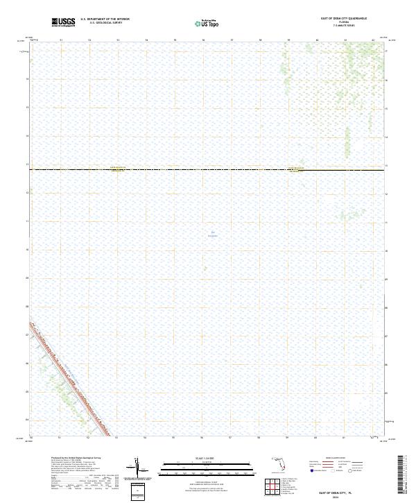
2024 Map of East of Deem City
USGS Topo · Published 2024About this map
The Everglades dominates this 2024 quadrangle, representing a preserved expanse of Florida's iconic wetland environment. The map details the administrative divide between Palm Beach Co and Broward Co, offering a technical look at the vast marshland that defines the interior of South Florida. Cutting across the southwestern corner, the North New River Canal provides a stark geometric contrast to the surrounding natural terrain. This waterway serves as a critical piece of drainage infrastructure, illustrating the decades-long effort to manage water levels within the ecosystem. The lack of traditional street grids or residential settlements emphasizes the area's role as a protected wilderness buffer between the Atlantic coast's urban sprawl and the deeper interior marshes.
Find a feature on this map
7 named features on this map. Tap any name to fly to it.
Don’t see what you’re looking for? This feature index may not catch every label — zoom into the map to look around manually.
Map Details
Editions of this 2024 East of Deem City Map
This is the sole edition of this map. No revisions or reprints were ever made.
Other maps of this area

1956 · West Palm Beach
USGS Topo · 1:250,000

1957 · West Palm Beach
USGS Topo · 1:250,000

1958 · West Palm Beach
USGS Topo · 1:250,000

1963 · Andytown
USGS Topo · 1:24,000

1963 · Fort Lauderdale 2 SE
USGS Topo · 1:24,000
1963 · Cooper City NE
USGS Topo · 1:24,000

1973 · Everglades 4 NE
USGS Topo · 1:24,000
1973 · Fort Lauderdale 2 NE
USGS Topo · 1:24,000

1973 · Fort Lauderdale 2 SW
USGS Topo · 1:24,000

1974 · Everglades 1 SE
USGS Topo · 1:24,000