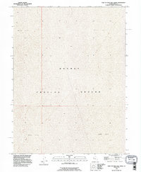
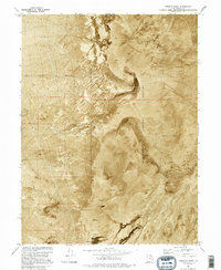
1993 Map of East of Gold Hill Wash
USGS Topo · Published 1996About this map
Dugway Proving Ground occupies the center of this remote desert landscape in western Utah, reflecting the restricted nature of the Great Salt Lake Desert in the late twentieth century. The terrain is dominated by a expansive Mud Flat, where the absence of roads, buildings, or water sources underscores the isolation of this military testing range. Surveyed primarily through 1973 imagery and updated in the 1990s, the map reveals a stark environment defined by subtle elevation changes and the rigid boundaries of the Public Land Survey System, including T 7 S and T 8 S. This document is a record of a strictly controlled government landscape where natural topography and military operations intersect.
Find a feature on this map
5 named features on this map. Tap any name to fly to it.
Don’t see what you’re looking for? This feature index may not catch every label — zoom into the map to look around manually.
Map Details
Editions of this 1993 East of Gold Hill Wash Map
This is the sole edition of this map. No revisions or reprints were ever made.
Other maps of this area

1953 · Tooele
USGS Topo · 1:250,000

1955 · Tooele
USGS Topo · 1:250,000
1973 · Gold Hill 4 SE
USGS Topo · 1:24,000

1973 · Wildcat Mountain SW
USGS Topo · 1:24,000

1973 · Gold Hill 1 SE
USGS Topo · 1:24,000

1973 · Gold Hill 1 SW
USGS Topo · 1:24,000

1973 · Granite Peak NW
USGS Topo · 1:24,000
1973 · Granite Peak SW
USGS Topo · 1:24,000
1973 · Gold Hill 4 NE
USGS Topo · 1:24,000
1973 · Goshute Wash
USGS Topo · 1:24,000