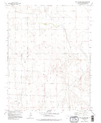
1982 Map of East Of Lewis Lake
USGS Topo · Published 1995About this map
Big Sandy Creek winds through this expanse of the High Plains, carving a shallow valley through the arid landscape of eastern Colorado. The terrain is defined by its agricultural and extractive utility, marked by numerous wells and a central Drill Hole that indicate the area's subterranean resources. While large settlements are absent, the map documents the essential infrastructure of rural life in the late twentieth century, including Storage Bins for harvested grain and the confluence where Eureka Creek joins the larger drainage system. The layout of section lines and fence lines reveals a strictly organized grid of land ownership typical of the region, where water sources like the creeks remained the primary anchors for local activity and land use.
Find a feature on this map
7 named features on this map. Tap any name to fly to it.
Don’t see what you’re looking for? This feature index may not catch every label — zoom into the map to look around manually.
Map Details
Editions of this 1982 East Of Lewis Lake Map
2 editions found
Other maps of this area

1891 · Kit Carson
USGS Topo · 1:125,000

1893 · Kit Carson
USGS Topo · 1:125,000

1954 · Lamar
USGS Topo · 1:250,000

1958 · Lamar
USGS Topo · 1:250,000

1981 · Cheyenne Wells
USGS Topo · 1:100,000
1982 · Kit Carson 4 SE
USGS Topo · 1:24,000
1982 · Kit Carson
USGS Topo · 1:24,000

1982 · Kit Carson 4 NE
USGS Topo · 1:24,000

1982 · Kit Carson 4 NW
USGS Topo · 1:24,000
1982 · Firstview
USGS Topo · 1:24,000