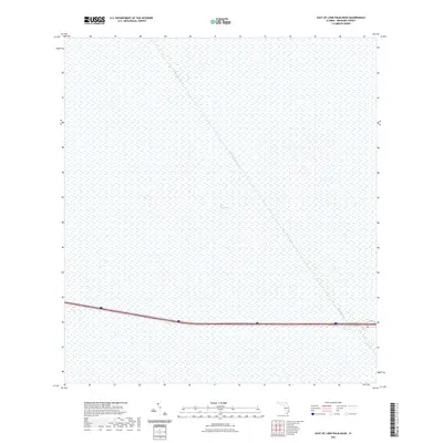
2021 Map of East of Lone Palm Head
USGS Topo · Published 2021About this map
The Everglades dominates this 2021 topographic study, appearing as a vast wetland expanse in Broward County. The landscape is defined by its characteristic hydrology, specifically the prominent diagonal course of the Miami Canal which cuts through the sawgrass marshes and sloughs. This engineering feature represents the long-standing efforts to manage water flow across southern Florida. Near the southern edge of the map, modern infrastructure is represented by the corridors of Interstate 75 and State Road 84, showing the thin line of human transit that skirts the conservation area. The map provides a precise look at the interface between primary drainage canals and the protected natural environment of the glades.
Find a feature on this map
4 named features on this map. Tap any name to fly to it.
Don’t see what you’re looking for? This feature index may not catch every label — zoom into the map to look around manually.
Map Details
Editions of this 2021 East of Lone Palm Head Map
This is the sole edition of this map. No revisions or reprints were ever made.
Other maps of this area

1956 · West Palm Beach
USGS Topo · 1:250,000

1957 · West Palm Beach
USGS Topo · 1:250,000

1958 · West Palm Beach
USGS Topo · 1:250,000

1973 · Everglades 4 NW
USGS Topo · 1:24,000

1973 · Everglades 4 NE
USGS Topo · 1:24,000

1973 · Everglades 4 SE
USGS Topo · 1:24,000

1973 · Everglades 4 SW
USGS Topo · 1:24,000

1973 · Everglades 3 NE
USGS Topo · 1:24,000

1974 · Everglades 1 SW
USGS Topo · 1:24,000

1974 · Everglades 2 SE
USGS Topo · 1:24,000