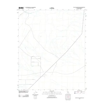
2012 Map of East of Victory Pass
USGS Topo · Published 2012About this map
The Colorado River Aqueduct traverses the northern reaches of this desert landscape in Riverside County, highlighting the critical infrastructure required to transport water across the arid California interior. Below the aqueduct, the terrain is defined by the natural drainage of Pinto Wash, which creates a network of dry channels across the alluvial plain. The mid-to-lower portion of the map reveals a burgeoning grid of rural roads, suggesting early-stage land development or desert homesteading. Names like Moonbeam Rd, Sidewinder Rd, and Little Bear Rd mark out large rectangular parcels. Further south, more formal street names such as Plantation St, Investor Ave, and Belsby Ave indicate a transition toward planned residential or agricultural zoning in the open desert during the early 21st century.
Find a feature on this map
13 named features on this map. Tap any name to fly to it.
Don’t see what you’re looking for? This feature index may not catch every label — zoom into the map to look around manually.
Map Details
Editions of this 2012 East of Victory Pass Map
This is the sole edition of this map. No revisions or reprints were ever made.
Other maps of this area

1943 · Coxcomb Mountains
USGS Topo · 1:62,500

1944 · Chuckwalla Mountains
USGS Topo · 1:62,500

1944 · Coxcomb Mountains
USGS Topo · 1:62,500

1952 · Sidewinder Well
USGS Topo · 1:62,500

1952 · Palen Mountains
USGS Topo · 1:62,500

1954 · Salton Sea
USGS Topo · 1:250,000

1955 · Salton Sea
USGS Topo · 1:250,000

1959 · Salton Sea
USGS Topo · 1:250,000

1963 · Salton Sea
USGS Topo · 1:250,000

1963 · Chuckwalla Mountains
USGS Topo · 1:62,500