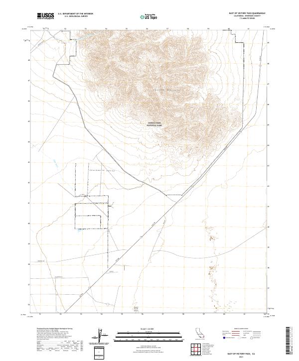
2021 Map of East of Victory Pass
USGS Topo · Published 2021About this map
Joshua Tree National Park occupies the central and eastern portions of this California desert landscape, where the sharp elevations of the Coxcomb Mountains meet the broad expanse of the Chuckwalla Valley. The arid terrain is defined by its infrastructure and water management, most notably the winding path of the Colorado River Aqueduct as it cuts across the northern desert floor. To the south, the grid of the desert floor becomes more apparent near the Desert Center Airport, where a collection of local thoroughfares including Plantation St and Carr Rd intersect the diagonal route of Rice Rd. This survey documents the relationship between federally protected lands and the essential utility corridors that sustain the region, providing a precise view of the dry washes like Pinto Wash that drain the mountain slopes.
Find a feature on this map
18 named features on this map. Tap any name to fly to it.
Don’t see what you’re looking for? This feature index may not catch every label — zoom into the map to look around manually.
Map Details
Editions of this 2021 East of Victory Pass Map
This is the sole edition of this map. No revisions or reprints were ever made.
Other maps of this area

1943 · Coxcomb Mountains
USGS Topo · 1:62,500

1944 · Chuckwalla Mountains
USGS Topo · 1:62,500

1944 · Coxcomb Mountains
USGS Topo · 1:62,500

1952 · Sidewinder Well
USGS Topo · 1:62,500

1952 · Palen Mountains
USGS Topo · 1:62,500

1954 · Salton Sea
USGS Topo · 1:250,000

1955 · Salton Sea
USGS Topo · 1:250,000

1959 · Salton Sea
USGS Topo · 1:250,000

1963 · Salton Sea
USGS Topo · 1:250,000

1963 · Chuckwalla Mountains
USGS Topo · 1:62,500