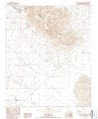
1987 Map of East of Victory Pass
USGS Topo · Published 1987About this map
The Coxcomb Mountains dominate the northern landscape of this Riverside County region, their sharp relief contrasting with the expansive basins of the Chuckwalla Valley and Palen Valley. In this mid-1980s environment, the interplay between desert hydrology and industry is evident, with Palen Lake situated near shifting Sand Dunes and scattered prospects marking the foothills. The presence of the Desert Center Airport in the south provides a localized center of activity within the arid flats, while the terrain's geological history is etched into the landscape by numerous gravel pits and isolated water wells. This survey documents a critical junction of mountain ranges and valley floors just prior to modern expansion, preserving the locations of early mineral exploration and remote infrastructure.
Find a feature on this map
11 named features on this map. Tap any name to fly to it.
Don’t see what you’re looking for? This feature index may not catch every label — zoom into the map to look around manually.
Map Details
Editions of this 1987 East of Victory Pass Map
This is the sole edition of this map. No revisions or reprints were ever made.
Other maps of this area

1943 · Coxcomb Mountains
USGS Topo · 1:62,500

1944 · Chuckwalla Mountains
USGS Topo · 1:62,500

1944 · Coxcomb Mountains
USGS Topo · 1:62,500

1952 · Sidewinder Well
USGS Topo · 1:62,500

1952 · Palen Mountains
USGS Topo · 1:62,500

1954 · Salton Sea
USGS Topo · 1:250,000

1955 · Salton Sea
USGS Topo · 1:250,000

1959 · Salton Sea
USGS Topo · 1:250,000

1963 · Salton Sea
USGS Topo · 1:250,000

1963 · Chuckwalla Mountains
USGS Topo · 1:62,500