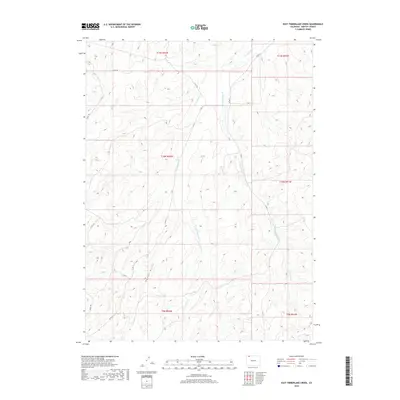
2019 Map of East Timberlake Creek
USGS Topo · Published 2019About this map
Timberlake Creek and its primary tributaries define this corner of Moffat County, carving deep drainage patterns through a high-altitude landscape. This 2019 survey captures the drainage network of W Timberlake Creek and E Timberlake Creek as they converge in the northern sections of the quadrangle. The terrain is marked by significant topographical relief, notably at Housel Gulch in the southwest. A sparse grid of county roads provides the only infrastructure through this open country, including County Road 102 and County Road 3. The map serves as a contemporary record of land divisions across several townships, including T10N R92W and T11N R91W, showing the relationship between natural watercourses and the established rural road network that facilitates movement through these wide basins.
Find a feature on this map
17 named features on this map. Tap any name to fly to it.
Don’t see what you’re looking for? This feature index may not catch every label — zoom into the map to look around manually.
Map Details
Editions of this 2019 East Timberlake Creek Map
This is the sole edition of this map. No revisions or reprints were ever made.
Other maps of this area
1916 · Craig
USGS Topo · 1:125,000

1954 · Craig
USGS Topo · 1:250,000
1957 · Craig
USGS Topo · 1:250,000
1958 · Craig
USGS Topo · 1:250,000
1960 · Craig
USGS Topo · 1:250,000
1962 · Craig
USGS Topo · 1:250,000
1964 · Craig
USGS Topo · 1:250,000
1965 · Craig
USGS Topo · 1:250,000
1969 · Great Divide
USGS Topo · 1:24,000
1969 · Fortification
USGS Topo · 1:24,000