
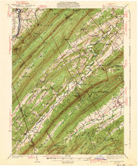
1941 Map of East Waterford
USGS Topo · Published 1941About this map
Tuscarora Mountain and Shade Mountain define the parallel ridges of this Central Pennsylvania landscape, where narrow valleys dictate the path of settlement and transport. Surveyed in the mid-1930s, the map reveals a network of rural schoolhouses and small crossroads communities like East Waterford and McCullochs Mills. The prominence of the Tuscarora Trail and the presence of a Fire Tower and Airway Beacon atop the ridge indicate the era’s reliance on high-ground navigation for both hikers and early aviators.
Find a feature on this map
82 named features on this map. Tap any name to fly to it.
Don’t see what you’re looking for? This feature index may not catch every label — zoom into the map to look around manually.
Map Details
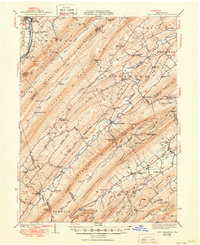
Editions of this 1941 East Waterford Map
3 editions found
Other maps of this area

1919 · Newville
USGS Topo · 1:62,500

1919 · Mattawana
USGS Topo · 1:62,500

1919 · Menno
USGS Topo · 1:62,500

1922 · Mt Union
USGS Topo · 1:48,000

1923 · Shippensburg
USGS Topo · 1:62,500

1924 · Mt. Union
USGS Topo · 1:62,500

1924 · Lewistown
USGS Topo · 1:62,500

1925 · Mifflintown
USGS Topo · 1:48,000

1927 · Lewisburg
USGS Topo · 1:62,500

1930 · Loysville
USGS Topo · 1:62,500