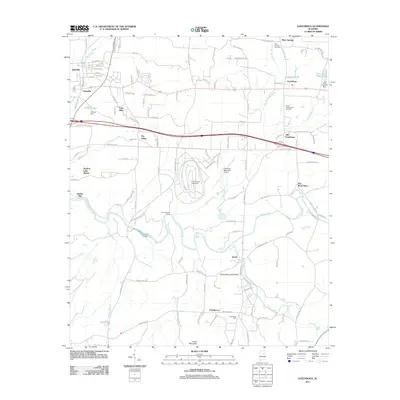
2011 Map of Eastaboga
USGS Topo · Published 2011About this map
International Speedway and the Talladega Municipal Airport dominate the central landscape of this 2011 survey, situated within Dry Valley. The area is defined by the winding course of Choccolocco Creek and its many tributaries, including Plum Springs Branch and Eastaboga Creek. Evidence of early settlement patterns remains visible in the proximity of Old Eastaboga and Eastaboga, while the presence of The Brick Store and Smiths Mill points to the historic local economy. Genealogists may find value in the documentation of the Plum Springs Cemetery and Groce-Montgomery Cemetery. The map also captures several smaller communities such as Yatesville, Echo Hills, and Providence, alongside family-named landmarks like Franksdale Farm and the geographic prominence of Schoolhouse Mountain.
Find a feature on this map
118 named features on this map. Tap any name to fly to it.
Don’t see what you’re looking for? This feature index may not catch every label — zoom into the map to look around manually.
Map Details
Editions of this 2011 Eastaboga Map
This is the sole edition of this map. No revisions or reprints were ever made.
Other maps of this area

1889 · Springville
USGS Topo · 1:125,000

1890 · Talladega
USGS Topo · 1:125,000

1891 · Ashland
USGS Topo · 1:125,000

1892 · Springville
USGS Topo · 1:125,000

1892 · Talladega
USGS Topo · 1:125,000

1900 · Anniston
USGS Topo · 1:125,000

1943 · Talladega
USGS Topo · 1:62,500

1946 · Talladega
USGS Topo · 1:62,500

1947 · Eastaboga
USGS Topo · 1:24,000

1947 · Ragland
USGS Topo · 1:62,500