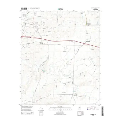
2014 Map of Eastaboga
USGS Topo · Published 2014About this map
Choccolocco Cr and its tributaries, including Eastaboga Cr and Stoney Br, carve a winding path through the heart of this Talladega and Calhoun County borderland. The landscape is defined by the transition from the structured residential blocks of Lincoln and Yatesville in the northwest to the more open, agricultural valley floor of Dry Valley. Historical centers of activity like Smiths Mill and the settlement of Turner sit near the water, while Old Eastaboga remains a distinct point of interest east of the more modern transportation corridors.
Find a feature on this map
127 named features on this map. Tap any name to fly to it.
Don’t see what you’re looking for? This feature index may not catch every label — zoom into the map to look around manually.
Map Details
Editions of this 2014 Eastaboga Map
This is the sole edition of this map. No revisions or reprints were ever made.
Other maps of this area

1889 · Springville
USGS Topo · 1:125,000

1890 · Talladega
USGS Topo · 1:125,000

1891 · Ashland
USGS Topo · 1:125,000

1892 · Springville
USGS Topo · 1:125,000

1892 · Talladega
USGS Topo · 1:125,000

1900 · Anniston
USGS Topo · 1:125,000

1943 · Talladega
USGS Topo · 1:62,500

1946 · Talladega
USGS Topo · 1:62,500

1947 · Eastaboga
USGS Topo · 1:24,000

1947 · Ragland
USGS Topo · 1:62,500