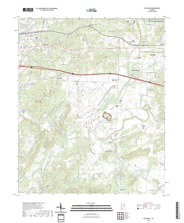
2024 Map of Eastaboga
USGS Topo · Published 2024About this map
Lincoln and Eastaboga anchor this survey of the Alabama landscape where the boundaries of Talladega and Calhoun counties meet. The terrain is defined by the winding course of Choccolocco Creek and its many tributaries, including Eastaboga Creek and Chedha Creek. Historically significant sites for genealogists include the Allen Elston 1860 Cem and Indian Hill Farm Cem, alongside numerous country sanctuaries such as Marble Springs Church and Pine Grove CME Church. The transition from rural life to modern infrastructure is evident, with the Talladega Municipal Airport and a portion of the Anniston Army Depot established near older landmarks like Smiths Mill and the rising profile of Schoolhouse Mtn. This record illustrates the persistence of small communities like Dry Valley and Turner amidst evolving regional transport and industry.
Find a feature on this map
116 named features on this map. Tap any name to fly to it.
Don’t see what you’re looking for? This feature index may not catch every label — zoom into the map to look around manually.
Map Details
Editions of this 2024 Eastaboga Map
This is the sole edition of this map. No revisions or reprints were ever made.
Other maps of this area

1889 · Springville
USGS Topo · 1:125,000

1890 · Talladega
USGS Topo · 1:125,000

1891 · Ashland
USGS Topo · 1:125,000

1892 · Springville
USGS Topo · 1:125,000

1892 · Talladega
USGS Topo · 1:125,000

1900 · Anniston
USGS Topo · 1:125,000

1943 · Talladega
USGS Topo · 1:62,500

1946 · Talladega
USGS Topo · 1:62,500

1947 · Eastaboga
USGS Topo · 1:24,000

1947 · Ragland
USGS Topo · 1:62,500