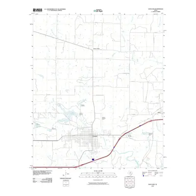
2010 Map of Eastland
USGS Topo · Published 2010About this map
Eastland serves as the central hub of this West Texas landscape, positioned at a significant transit corridor where modern interstate travel meets the path of the Old Bankhead Hwy. The town's grid is bounded to the north by the North Fork Leon River and its associated waterworks, including the Lake Eastland Dam. To the east, the settlement of Olden sits along the rail lines, while Morton Valley occupies the northern reaches of the quadrangle. A network of county roads, such as Colony School Rd and Pleasant Grove Rd, suggests the agricultural and community roots of the surrounding countryside. Water management is a defining feature of the area, evidenced by a series of reservoirs and dams like Ringling Lake Dam and Old City Lake Dam, which supported the region's growth and infrastructure during the mid-20th century development of Eastland County.
Find a feature on this map
56 named features on this map. Tap any name to fly to it.
Don’t see what you’re looking for? This feature index may not catch every label — zoom into the map to look around manually.
Map Details
Editions of this 2010 Eastland Map
This is the sole edition of this map. No revisions or reprints were ever made.
Other maps of this area

1890 · Breckenridge
USGS Topo · 1:125,000

1894 · Eastland
USGS Topo · 1:125,000

1954 · Abilene
USGS Topo · 1:250,000

1958 · Abilene
USGS Topo · 1:250,000

1966 · Cisco North
USGS Topo · 1:24,000

1966 · Kokomo
USGS Topo · 1:24,000

1966 · Carbon
USGS Topo · 1:24,000

1966 · Eastland
USGS Topo · 1:24,000

1966 · Cisco South
USGS Topo · 1:24,000

1966 · Ranger
USGS Topo · 1:24,000