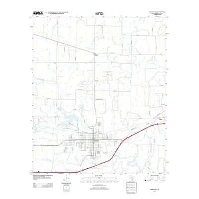
2012 Map of Eastland
USGS Topo · Published 2012About this map
Eastland serves as the central hub of this West Texas landscape, showing a dense residential grid transitioning into the surrounding ranch and oil country. The city's growth is oriented around the N Fork Leon River and the Leon River, with local infrastructure including the Eastland Municipal Airport. To the east, the settlement of Olden sits near the Borrow Pit Reservoir and Lake Olden, reflecting the region's reliance on managed water resources.
Find a feature on this map
90 named features on this map. Tap any name to fly to it.
Don’t see what you’re looking for? This feature index may not catch every label — zoom into the map to look around manually.
Map Details
Editions of this 2012 Eastland Map
This is the sole edition of this map. No revisions or reprints were ever made.
Other maps of this area

1890 · Breckenridge
USGS Topo · 1:125,000

1894 · Eastland
USGS Topo · 1:125,000

1954 · Abilene
USGS Topo · 1:250,000

1958 · Abilene
USGS Topo · 1:250,000

1966 · Cisco North
USGS Topo · 1:24,000

1966 · Kokomo
USGS Topo · 1:24,000

1966 · Carbon
USGS Topo · 1:24,000

1966 · Eastland
USGS Topo · 1:24,000

1966 · Cisco South
USGS Topo · 1:24,000

1966 · Ranger
USGS Topo · 1:24,000