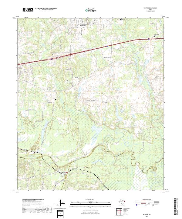
2022 Map of Easton
USGS Topo · Published 2022About this map
The Sabine River snakes across the landscape, forming the natural boundary between Harrison, Gregg, and Rusk counties. This modern topographic view centers on Easton and the southern outskirts of Hallsville, where the terrain transitions from upland ridges down to the marshy bottomlands of Cherokee Bayou and Black Slough. The area is marked by a high density of small family and community burial grounds, such as the Bray Family Cem and the Forrest- Rogers- Dollahite Cem, providing a detailed record of local settlement and family roots.
Find a feature on this map
76 named features on this map. Tap any name to fly to it.
Don’t see what you’re looking for? This feature index may not catch every label — zoom into the map to look around manually.
Map Details
Editions of this 2022 Easton Map
This is the sole edition of this map. No revisions or reprints were ever made.
Other maps of this area

1956 · Tyler
USGS Topo · 1:250,000

1958 · Darco
USGS Topo · 1:62,500

1958 · Tatum
USGS Topo · 1:62,500

1961 · Hallsville
USGS Topo · 1:24,000

1962 · Marshall West
USGS Topo · 1:24,000

1962 · Longview Heights
USGS Topo · 1:24,000

1983 · Tatum
USGS Topo · 1:24,000

1983 · Harris Chapel
USGS Topo · 1:24,000

1983 · Easton
USGS Topo · 1:24,000
1983 · Lakeport
USGS Topo · 1:24,000