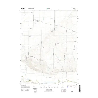
2015 Map of Easton
USGS Topo · Published 2015About this map
Easton and the small settlement of Teheran anchor this central Illinois landscape, where the flat upland agricultural plains give way to the complex hydrology of the Sangamon River valley. The map reveals an extensive network of drainage projects essential to the local farming economy, including Samuels Ditch, Hall Ditch, and Ross Tyrell Ditch. To the south, the terrain shifts into the alluvial lowlands of Herget Bottoms and the depression known as Sleepy Hollow, where the Sleepy Hollow Ditch feeds toward the river system.
Find a feature on this map
60 named features on this map. Tap any name to fly to it.
Don’t see what you’re looking for? This feature index may not catch every label — zoom into the map to look around manually.
Map Details
Editions of this 2015 Easton Map
This is the sole edition of this map. No revisions or reprints were ever made.
Other maps of this area

1929 · Manito
USGS Topo · 1:62,500

1932 · Manito
USGS Topo · 1:62,500

1933 · Petersburg
USGS Topo · 1:62,500

1938 · Petersburg
USGS Topo · 1:62,500

1942 · Delavan
USGS Topo · 1:62,500

1948 · Mason City
USGS Topo · 1:62,500

1949 · Mason City
USGS Topo · 1:62,500

1958 · Peoria
USGS Topo · 1:250,000

1961 · Peoria
USGS Topo · 1:250,000

1963 · Peoria
USGS Topo · 1:250,000