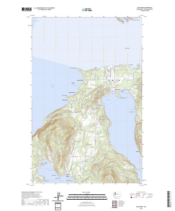
2023 Map of Eastsound
USGS Topo · Published 2023About this map
Orcas Island dominates this northern reach of the archipelago, centered on the community of Eastsound at the head of East Sound. The island's geography is defined by significant elevations like Turtleback Mtn and Orcas Knob, which rise above the fertile Crow Valley. This modern survey reveals the persistent structure of long-standing settlements and coastal camps, such as Camp Orkila and Beach Haven. On the eastern shore, the resort of Rosario sits below Rosario Hill, while the western coast features smaller landings like West Sound near Massacre Bay.
Find a feature on this map
154 named features on this map. Tap any name to fly to it.
Don’t see what you’re looking for? This feature index may not catch every label — zoom into the map to look around manually.
Map Details
Editions of this 2023 Eastsound Map
This is the sole edition of this map. No revisions or reprints were ever made.
Other maps of this area

1943 · Orcas Island
USGS Topo · 1:62,500

1954 · Waldron Island
USGS Topo · 1:24,000

1954 · Friday Harbor
USGS Topo · 1:24,000

1957 · Orcas Island
USGS Topo · 1:62,500

1957 · Victoria
USGS Topo · 1:250,000

1973 · Sucia Island
USGS Topo · 1:24,000

1973 · Shaw Island
USGS Topo · 1:24,000
1973 · Blakely Island
USGS Topo · 1:24,000

1975 · Bellingham
USGS Topo · 1:100,000
1977 · Eastsound
USGS Topo · 1:24,000