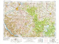
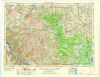
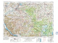
1953 Map of Eau Claire
USGS Topo · Published 1978About this map
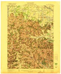
The Chippewa and Eau Claire River confluence anchors this mid-century look at West Central Wisconsin, where the industrial and rail hubs of Eau Claire and Chippewa Falls emerge from a landscape of glacial mounds and transition forest. The region's diverse land use is evident in the sprawling Fort Mc Coy Military Reservation and the protected marshes of the Necedah National Wildlife Refuge. To the east, the intensive cranberry-growing district around Pittsville and the logging-legacy topography of the Black River State Forest provide sharp contrast to the dairy-rich farmland surrounding Marshfield. This 1970s revision of a 1950s base reveals the enduring footprint of major railroads like the Soo Line and the Chicago and North Western, while charting the complex terrain of the Driftless Area through features like Silver Mound and Sugar Loaf Mound.
Find a feature on this map
284 named features on this map. Tap any name to fly to it.
Don’t see what you’re looking for? This feature index may not catch every label — zoom into the map to look around manually.
Map Details
Editions of this 1953 Eau Claire Map
4 editions found

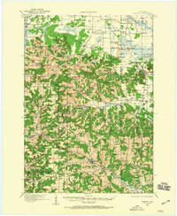
Other maps of this area

1902 · Marathon
USGS Topo · 1:125,000

1909 · Sparta
USGS Topo · 1:62,500

1916 · Tomah
USGS Topo · 1:62,500
1919 · Kendall
USGS Topo · 1:62,500

1921 · Mauston
USGS Topo · 1:62,500
1921 · Kendall
USGS Topo · 1:62,500

1924 · Black River Falls
USGS Topo · 1:62,500

1926 · Black River Falls
USGS Topo · 1:62,500

1926 · North Bend
USGS Topo · 1:62,500

1926 · Whitehall
USGS Topo · 1:62,500