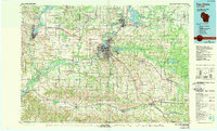
1985 Map of Eau Claire
USGS Topo · Published 1989About this map
Eau Claire serves as the focal point of this regional study, situated at the confluence of the Chippewa River and the Eau Claire River. The mid-1980s landscape reveals a complex network of industrial and transport infrastructure, including the Soo Line and C & NW railroads that once defined the area's timber and milling economy. North of the city, the massive Lake Wissota and Dells Pond show the significant engineering of the river system for power and recreation, while smaller settlements like Old Albertville and Colfax suggest the persistent agricultural character of the surrounding townships.
Find a feature on this map
151 named features on this map. Tap any name to fly to it.
Don’t see what you’re looking for? This feature index may not catch every label — zoom into the map to look around manually.
Map Details
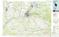
Editions of this 1985 Eau Claire Map
2 editions found
Other maps of this area

1924 · Black River Falls
USGS Topo · 1:62,500

1926 · Black River Falls
USGS Topo · 1:62,500

1926 · Whitehall
USGS Topo · 1:62,500

1927 · Blair
USGS Topo · 1:62,500

1927 · Strum
USGS Topo · 1:62,500

1929 · Whitehall
USGS Topo · 1:62,500

1929 · Durand
USGS Topo · 1:62,500

1930 · Strum
USGS Topo · 1:62,500

1932 · Gilmanton
USGS Topo · 1:62,500

1932 · Wabasha
USGS Topo · 1:62,500