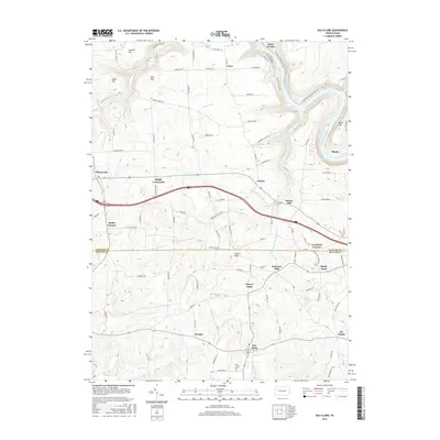
2016 Map of Eau Claire
USGS Topo · Published 2016About this map
Eau Claire anchors this landscape at the intersection of Butler and Venango counties, where rural crossroads and historical mill sites define the community structure. The terrain is deeply carved by the Allegheny River and its numerous tributaries, including Scrubgrass Creek and the branching forks of Little Scrubgrass Creek. Local history is preserved in small settlements such as Cherry Valley and De Sale, alongside older industrial landmarks like Sutton Mill and Sedwicks Mill. The northeastern corner of the map features a segment of the North Country National Scenic Trail as it winds near Saint George and the river banks. This survey captures a transition from the elevated peaks of Summit Hill and Pine Hill down to the creek valleys, showing the persistent rural road network connecting Riddle Crossroads to the outlying Six Points.
Find a feature on this map
102 named features on this map. Tap any name to fly to it.
Don’t see what you’re looking for? This feature index may not catch every label — zoom into the map to look around manually.
Map Details
Editions of this 2016 Eau Claire Map
This is the sole edition of this map. No revisions or reprints were ever made.
Other maps of this area

1907 · Foxburg
USGS Topo · 1:62,500

1908 · Foxburg
USGS Topo · 1:62,500

1909 · Franklin
USGS Topo · 1:62,500

1910 · Hilliards
USGS Topo · 1:62,500

1911 · Franklin
USGS Topo · 1:62,500

1912 · Hilliards
USGS Topo · 1:62,500

1922 · Oil City
USGS Topo · 1:48,000

1924 · Oil City
USGS Topo · 1:62,500

1943 · Oil City
USGS Topo · 1:62,500

1944 · Hilliards
USGS Topo · 1:62,500