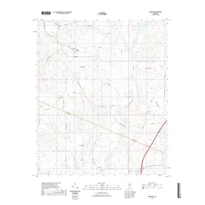
2020 Map of Ebenezer
USGS Topo · Published 2020About this map
Ebenezer serves as a central hub in this rural Mississippi landscape, defined by a network of family-named roads and scattered burial grounds. The community is anchored by the Ebenezer Baptist Church Cem and Ebenezer Methodist Church Cem, reflecting the deep-rooted social and religious history of Holmes County. The terrain is marked by seasonal waterways and wetlands, including Bisland Bayou and the winding Cypress Creek, which influence the local drainage and land use patterns.
Find a feature on this map
56 named features on this map. Tap any name to fly to it.
Don’t see what you’re looking for? This feature index may not catch every label — zoom into the map to look around manually.
Map Details
Editions of this 2020 Ebenezer Map
This is the sole edition of this map. No revisions or reprints were ever made.
Other maps of this area

1940 · Lexington
USGS Topo · 1:62,500

1953 · Meridian
USGS Topo · 1:250,000

1953 · Greenwood
USGS Topo · 1:250,000

1953 · West Point
USGS Topo · 1:250,000

1955 · Jackson
USGS Topo · 1:250,000

1956 · Greenwood
USGS Topo · 1:250,000

1957 · Meridian
USGS Topo · 1:250,000

1957 · Lexington
USGS Topo · 1:62,500

1958 · West Point
USGS Topo · 1:250,000

1958 · Lexington
USGS Topo · 1:62,500