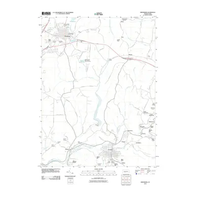
2010 Map of Ebensburg
USGS Topo · Published 2010About this map
Ebensburg serves as a primary hub in this central Cambria County landscape, where the plateau terrain is defined by the headwaters of the North Branch Little Conemaugh River and Clearfield Creek. The map reveals a high concentration of cemeteries and local landmarks, such as the Cambria County Fairground and Krug Airport, reflecting long-established community footprints. To the south, the industrial and residential density increases around Portage and Wilmore, where the Little Conemaugh River corridor is marked by features like the Miller Shaft and the Wilmore Dam. Smaller named settlements such as Munster, Cassandra, and Noel are interspersed among agricultural tracts and woodland, connected by a network including the Admiral Peary Hwy. Numerous burial sites, including the Saint Bartholomew Cemeteries and Saints Peter and Paul Cemetery, provide significant data for genealogical research in these coal-country townships.
Find a feature on this map
104 named features on this map. Tap any name to fly to it.
Don’t see what you’re looking for? This feature index may not catch every label — zoom into the map to look around manually.
Map Details
Editions of this 2010 Ebensburg Map
This is the sole edition of this map. No revisions or reprints were ever made.
Other maps of this area

1902 · Ebensburg
USGS Topo · 1:62,500

1902 · Patton
USGS Topo · 1:62,500

1902 · Barnesboro
USGS Topo · 1:62,500

1904 · Barnesboro
USGS Topo · 1:62,500

1904 · Patton
USGS Topo · 1:62,500

1904 · Ebensburg
USGS Topo · 1:62,500

1904 · Johnstown
USGS Topo · 1:62,500

1907 · Johnstown
USGS Topo · 1:62,500

1943 · Punxsutawney
USGS Topo · 1:125,000

1953 · Pittsburgh
USGS Topo · 1:250,000