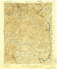
1932 Map of Eccles
USGS Topo · Published 1940About this map
Eccles and the surrounding coal-country plateaus are documented here during a period of intense rail-driven industrialization. The landscape is defined by the heavy presence of the Virginian and Chesapeake and Ohio railroads, which snake through deep hollows to serve settlements like Glen White and Westerly. This era reveals a remarkably dense network of rural infrastructure, with small, locally-named schools such as the Sandlick Caperton School and Jarrell School appearing at nearly every major creek fork. The topography is rugged, punctuated by prominent peaks like Irish Lick Knob and Packs Knob, which forced the early development into narrow corridors along Paint Creek and Marsh Fork. Genealogists will find a wealth of specific community markers, from the Matville Church to smaller hamlets like Sweeneyburg and Munition, reflecting the distributed nature of mountain life before modern highway consolidation.
Find a feature on this map
116 named features on this map. Tap any name to fly to it.
Don’t see what you’re looking for? This feature index may not catch every label — zoom into the map to look around manually.
Map Details
Editions of this 1932 Eccles Map
3 editions found
Other maps of this area

1891 · Oceana
USGS Topo · 1:125,000

1891 · Raleigh
USGS Topo · 1:125,000

1893 · Oceana
USGS Topo · 1:125,000

1897 · Kanawha Falls
USGS Topo · 1:125,000

1897 · Raleigh
USGS Topo · 1:125,000

1898 · Oceana
USGS Topo · 1:125,000

1899 · Charleston
USGS Topo · 1:125,000

1900 · Kanawha Falls
USGS Topo · 1:125,000

1901 · Kanawha Falls
USGS Topo · 1:125,000

1902 · Raleigh
USGS Topo · 1:125,000