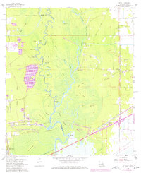
1960 Map of Echo
USGS Topo · Published 1976About this map
The Sabine River carves a winding path along the border of Louisiana and Texas, creating a complex geography of river bends, islands, and ridges. This 1960 landscape shows a river-dependent economy in transition, where the Southern Pacific railroad and the modern highway corridor at Toomey began to supersede the older river landings. The terrain is marked by numerous bluff points like Morgan Bluff and Niblett Bluff, and a series of ridges—Beef Ridge, Pine Ridge, and Bone Ridge—that offered stable ground amidst the surrounding wetlands of Tupelo Swamp and Gum Slough. Smaller settlements like Echo and Ridgecrest appear near the southern railroad lines, while family names are preserved at Lee Cem and Granger Cem. The dense network of water bodies, including Swift Lake and Old River, highlights the intricate hydrology of the Calcasieu Parish wetlands before major modern developments altered the drainage patterns.
Find a feature on this map
60 named features on this map. Tap any name to fly to it.
Don’t see what you’re looking for? This feature index may not catch every label — zoom into the map to look around manually.
Map Details
Editions of this 1960 Echo Map
4 editions found
Other maps of this area

1926 · Mauriceville
USGS Topo · 1:24,000

1932 · Orange
USGS Topo · 1:62,500

1943 · Orangefield
USGS Topo · 1:24,000

1943 · Mauriceville
USGS Topo · 1:24,000

1946 · Phoenix Lake
USGS Topo · 1:31,680

1947 · Starks
USGS Topo · 1:31,680

1947 · Vinton
USGS Topo · 1:31,680

1947 · Toomey
USGS Topo · 1:31,680

1947 · Lunita
USGS Topo · 1:31,680
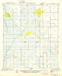
1949 · Cameron Farms
USGS Topo · 1:31,680