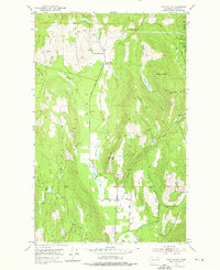
1952 Map of Echo Valley
USGS Topo · Published 1976About this map
Mining operations and small-scale agriculture define this Stevens County landscape as it appeared in the mid-20th century. The settlement of Echo serves as a local hub near the southern end of the prominent Echo Valley, supported by essential community landmarks like the Bruce Creek School and Bruce Creek Grange. The terrain is marked by numerous prospects and shafts, particularly around Bonanza Hill where the Bonanza Mine is located. Further east, a cluster of claims including the Leadville Mine, Hi Cliff Mine, and Eureka Surprise indicates the area's mineral importance.
Find a feature on this map
37 named features on this map. Tap any name to fly to it.
Don’t see what you’re looking for? This feature index may not catch every label — zoom into the map to look around manually.
Map Details
Editions of this 1952 Echo Valley Map
3 editions found
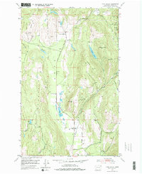
Other maps of this area

1929 · Colville
USGS Topo · 1:125,000

1933 · Colville
USGS Topo · 1:125,000

1936 · Marcus
USGS Topo · 1:96,000

1942 · Marcus
USGS Topo · 1:125,000

1948 · Kettle Falls
USGS Topo · 1:62,500

1948 · Orient
USGS Topo · 1:62,500

1951 · Orient
USGS Topo · 1:62,500

1951 · Kettle Falls
USGS Topo · 1:62,500

1952 · Gillette Mtn
USGS Topo · 1:24,000

1952 · Echo Valley
USGS Topo · 1:24,000