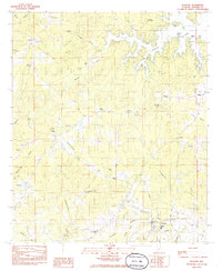
1984 Map of Eclectic
USGS Topo · Published 1985About this map
Eclectic serves as the primary hub in this central Alabama landscape, shown here in the mid-1980s. The town's grid is anchored by Castleberry Park and the local High Sch, while the surrounding countryside is defined by an intricate network of waterways including Channahatchee Creek and Chubbehatchee Creek. To the northeast, the jagged shoreline of Lake Martin creates a complex geography of inlets and named points such as Neros Point and Pine Point.
Find a feature on this map
45 named features on this map. Tap any name to fly to it.
Don’t see what you’re looking for? This feature index may not catch every label — zoom into the map to look around manually.
Map Details
Editions of this 1984 Eclectic Map
This is the sole edition of this map. No revisions or reprints were ever made.
Other maps of this area

1901 · Wetumpka
USGS Topo · 1:125,000

1901 · Wetumpka
USGS Topo · 1:62,500

1903 · Wetumpka
USGS Topo · 1:125,000

1906 · Dadeville
USGS Topo · 1:125,000

1953 · Montgomery
USGS Topo · 1:250,000

1955 · Phenix City
USGS Topo · 1:250,000

1956 · Montgomery
USGS Topo · 1:250,000

1957 · Phenix City
USGS Topo · 1:250,000

1957 · Montgomery
USGS Topo · 1:250,000

1958 · Phenix City
USGS Topo · 1:250,000