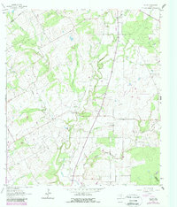
1961 Map of Ecleto
USGS Topo · Published 1987About this map
The Person Oil Field anchors this landscape in Karnes County, where the transition from ranching to petroleum extraction is evident in the network of pipelines and wells crisscrossing the rolling terrain. The area is defined by the winding course of Ecleto Creek and its many tributaries, including Rhymes Creek and Pridgeon Creek, which have carved out distinct features like Tom White Hollow. Local history is centered around the small settlements of Gillett, Harmony, and Ecleto, providing a clear look at the rural social structure of the early 1960s.
Find a feature on this map
22 named features on this map. Tap any name to fly to it.
Don’t see what you’re looking for? This feature index may not catch every label — zoom into the map to look around manually.
Map Details
Editions of this 1961 Ecleto Map
2 editions found
Other maps of this area

1920 · Smiley
USGS Topo · 1:125,000

1953 · Beeville
USGS Topo · 1:250,000

1953 · Seguin
USGS Topo · 1:250,000

1956 · Beeville
USGS Topo · 1:250,000

1956 · Karnes City
USGS Topo · 1:62,500

1958 · Seguin
USGS Topo · 1:250,000

1960 · Beeville
USGS Topo · 1:250,000
1960 · Karnes City
USGS Topo · 1:24,000

1960 · Kosciusko
USGS Topo · 1:24,000

1960 · Helena
USGS Topo · 1:24,000