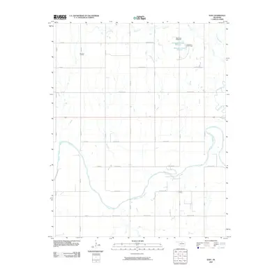
2009 Map of Eddy
USGS Topo · Published 2009About this map
The Salt Fork Arkansas River carves a broad, meandering path across the southern half of this landscape, defining the local geography alongside the intermittent flows of Deer Creek and Thompson Creek. The land is organized by a precise grid of rural roads, including W North Ave and Oakland Rd, which serve a territory defined by agricultural use and resource extraction. Evidence of the region's petroleum history is centered at the Thomas Oil Field, while local genealogy is anchored at the New Hope Cemetery in the northwest. To the north, water management is visible through small-scale infrastructure such as the Oknoname 071018 Reservoir and its associated Oknoname 071018 Dam. This survey documents a quiet rural corner of Oklahoma where the river remains the dominant natural feature amidst a human-imposed grid.
Find a feature on this map
35 named features on this map. Tap any name to fly to it.
Don’t see what you’re looking for? This feature index may not catch every label — zoom into the map to look around manually.
Map Details
Editions of this 2009 Eddy Map
This is the sole edition of this map. No revisions or reprints were ever made.
Other maps of this area

1955 · Enid
USGS Topo · 1:250,000

1958 · Enid
USGS Topo · 1:250,000

1968 · Lamont SE
USGS Topo · 1:24,000

1968 · Deer Creek
USGS Topo · 1:24,000

1968 · Billings
USGS Topo · 1:24,000

1968 · Tonkawa SE
USGS Topo · 1:24,000

1968 · Eddy
USGS Topo · 1:24,000

1968 · Nardin
USGS Topo · 1:24,000

1968 · Tonkawa
USGS Topo · 1:24,000

1968 · Lamont
USGS Topo · 1:24,000