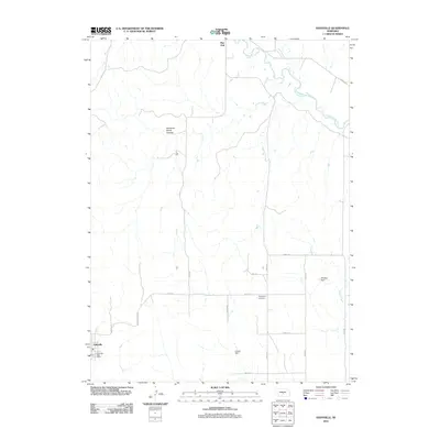
2011 Map of Eddyville
USGS Topo · Published 2011About this map
Eddyville anchors this survey of Dawson County, where the village lies south of the winding South Loup River. The landscape is defined by the river valley's drainage system, including Deer Creek and Kilgore Creek, and the presence of small-scale water management at Shadley Dam and Eutsler Dam. The grid of rural roads, such as Road 773 and Road 444, connects isolated landmarks that speak to the area's pioneer heritage and social geography. Notable among these are the Park Valley Cemetery and the northern settlement of Burr Oak. In the western portion of the quadrangle, the terrain becomes more distinct at Buzzards Roost Canyon, providing a break from the agricultural plains. This documentation captures the community infrastructure of the early 21st century, from the Eddyville Post Office to the local road networks that follow the section lines of the Nebraska prairie.
Find a feature on this map
23 named features on this map. Tap any name to fly to it.
Don’t see what you’re looking for? This feature index may not catch every label — zoom into the map to look around manually.
Map Details
Editions of this 2011 Eddyville Map
This is the sole edition of this map. No revisions or reprints were ever made.
Other maps of this area

1896 · Lexington
USGS Topo · 1:125,000

1896 · Kearney
USGS Topo · 1:125,000

1899 · Lexington
USGS Topo · 1:125,000

1951 · Eddyville NE
USGS Topo · 1:24,000

1951 · Mason City SW
USGS Topo · 1:24,000

1951 · Eddyville NW
USGS Topo · 1:24,000

1951 · Eddyville
USGS Topo · 1:24,000

1951 · Mason City NW
USGS Topo · 1:24,000

1951 · Eddyville SW
USGS Topo · 1:24,000

1955 · Broken Bow
USGS Topo · 1:250,000