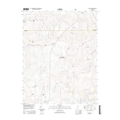
2015 Map of Eddyville
USGS Topo · Published 2015About this map
Shawnee National Forest encompasses much of this Pope County landscape, where the rugged topography is defined by deep drainages like Lusk Cr and Little Lusk Cr. The area is notably dense with family burial grounds and community graveyards, including the Evans Cemetary near the Saline County line and the Eddyville Cem to the south. Small settlements like Delwood and Oak serve as local landmarks along the winding forest roads. Natural features such as Barger Lake and the distinctively named Double Branch Hole indicate a landscape shaped by water and elevation, providing a clear look at the rural character of Southern Illinois in the mid-2010s. For genealogists, the numerous named cemeteries like Pleasant Ridge Cem and Reynolds Cemetery offer precise locations for ancestral research in this forested region.
Find a feature on this map
50 named features on this map. Tap any name to fly to it.
Don’t see what you’re looking for? This feature index may not catch every label — zoom into the map to look around manually.
Map Details
Editions of this 2015 Eddyville Map
This is the sole edition of this map. No revisions or reprints were ever made.
Other maps of this area

1916 · Golconda
USGS Topo · 1:62,500

1916 · Equality
USGS Topo · 1:62,500

1917 · Brownfield
USGS Topo · 1:62,500

1920 · Goloonda
USGS Topo · 1:48,000

1921 · Golconda
USGS Topo · 1:62,500

1925 · Harrisburg
USGS Topo · 1:62,500

1939 · Harrisburg
USGS Topo · 1:62,500

1949 · Paducah
USGS Topo · 1:250,000

1950 · Paducah
USGS Topo · 1:250,000

1954 · Paducah
USGS Topo · 1:250,000