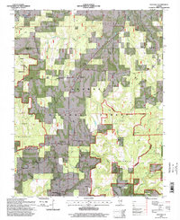
1996 Map of Eddyville
USGS Topo · Published 1998About this map
Shawnee National Forest dominates the terrain of northern Pope County, where deep incisions from Lusk Creek and Bear Branch define the landscape. The map reveals a dispersed rural pattern of family-named cemeteries and country churches that anchor the small communities of Delwood, Oak, and Eddyville. These settlements are connected by winding roads through wooded tracts and designated conservation areas like the Burden Falls Wilderness and Lusk Creek Natural Area (State).
Find a feature on this map
54 named features on this map. Tap any name to fly to it.
Don’t see what you’re looking for? This feature index may not catch every label — zoom into the map to look around manually.
Map Details
Editions of this 1996 Eddyville Map
This is the sole edition of this map. No revisions or reprints were ever made.
Other maps of this area

1916 · Golconda
USGS Topo · 1:62,500

1916 · Equality
USGS Topo · 1:62,500

1917 · Brownfield
USGS Topo · 1:62,500

1920 · Goloonda
USGS Topo · 1:48,000

1921 · Golconda
USGS Topo · 1:62,500

1925 · Harrisburg
USGS Topo · 1:62,500

1939 · Harrisburg
USGS Topo · 1:62,500

1949 · Paducah
USGS Topo · 1:250,000

1950 · Paducah
USGS Topo · 1:250,000

1954 · Paducah
USGS Topo · 1:250,000