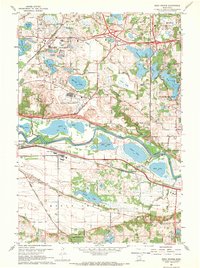
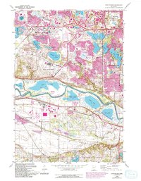
1967 Map of Eden Prairie
USGS Topo · Published 1969About this map
The Minnesota River meanders across the center of this landscape, defining the border between Hennepin and Scott Counties during a period of suburban expansion. To the north, the growing community of Eden Prairie is characterized by its numerous glacial lakes, including Staring Lake, Anderson Lakes, and Mitchell Lake. The presence of the Flying Cloud Airport and a Drive-in Theater reflects the mid-century development patterns of the Twin Cities' southwestern suburbs.
Find a feature on this map
56 named features on this map. Tap any name to fly to it.
Don’t see what you’re looking for? This feature index may not catch every label — zoom into the map to look around manually.
Map Details
Editions of this 1967 Eden Prairie Map
5 editions found
Other maps of this area

1896 · Minneapolis
USGS Topo · 1:62,500

1901 · Minneapolis
USGS Topo · 1:62,500

1905 · Minnetonka
USGS Topo · 1:62,500

1907 · Minnetonka
USGS Topo · 1:62,500

1952 · Minneapolis South
USGS Topo · 1:24,000

1953 · Saint Paul
USGS Topo · 1:250,000

1954 · Hopkins
USGS Topo · 1:24,000

1954 · Bloomington
USGS Topo · 1:24,000

1954 · Eden Prairie
USGS Topo · 1:24,000

1954 · Minneapolis
USGS Topo · 1:62,500