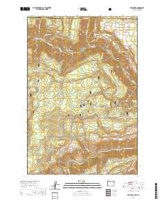
2020 Map of Eden Ridge
USGS Topo · Published 2020About this map
Umatilla National Forest occupies this high-elevation landscape along the border of Oregon and Washington. The terrain is defined by deep incisions like Burnt Canyon and Ward Canyon, which drop sharply away from plateaus such as Moore Flat and Grouse Flat. This area is shaped by its protected waterways, including the Wenaha Wild and Scenic River and the Grande Ronde Wild and Scenic River. For the local historian, the presence of the Eden Cem near Eden Ridge provides a specific point of interest in an otherwise sparsely populated forest environment. A network of backcountry routes, such as the Wenaha River Trail and Smooth Ridge Trail, connects various water sources like Hoodoo Spring and Thorn Spring, tracing the paths used for land management and recreation in the Blue Mountains region.
Find a feature on this map
45 named features on this map. Tap any name to fly to it.
Don’t see what you’re looking for? This feature index may not catch every label — zoom into the map to look around manually.
Map Details
Editions of this 2020 Eden Ridge Map
This is the sole edition of this map. No revisions or reprints were ever made.
Other maps of this area

1937 · Pomeroy
USGS Topo · 1:96,000

1942 · Pomeroy
USGS Topo · 1:125,000

1943 · Saddle Butte
USGS Topo · 1:62,500

1946 · Saddle Butte
USGS Topo · 1:62,500

1955 · Pullman
USGS Topo · 1:250,000

1955 · Grangeville
USGS Topo · 1:250,000

1958 · Pullman
USGS Topo · 1:250,000

1959 · Grangeville
USGS Topo · 1:250,000

1967 · Wood Butte
USGS Topo · 1:24,000

1967 · Troy
USGS Topo · 1:24,000