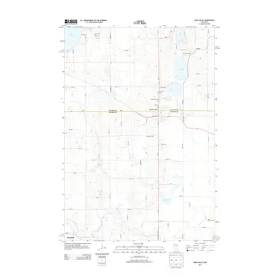
2013 Map of Eden Valley
USGS Topo · Published 2013About this map
Eden Valley sits at the intersection of Stearns and Meeker counties, serving as a central hub for the surrounding dairy farms and glacial lake country. The 2013 landscape is defined by its water and agricultural infrastructure, with Becker Dairy and Tyler Farms Airport punctuating the grid of township roads. The North Fork Crow River meanders through the southern portion of the quadrangle near Manannah, while the northern section is characterized by a high density of lakes including Rice Lake, Eden Lake, and the smaller Kalkenbrenner Lake. Genealogists will find significant value in the distribution of local burial sites, from Assumption Cem and Saint Peters Cem near the town center to the isolated Old Eden Lake Cem situated on the eastern shore of its namesake lake. The map also captures local recreation spots like Fishers Resort and Campground on the banks of Rice Lake.
Find a feature on this map
57 named features on this map. Tap any name to fly to it.
Don’t see what you’re looking for? This feature index may not catch every label — zoom into the map to look around manually.
Map Details
Editions of this 2013 Eden Valley Map
This is the sole edition of this map. No revisions or reprints were ever made.
Other maps of this area

1953 · Saint Cloud
USGS Topo · 1:250,000

1957 · Saint Cloud
USGS Topo · 1:250,000

1958 · Saint Cloud
USGS Topo · 1:250,000

1958 · Dassel
USGS Topo · 1:62,500

1967 · Cold Spring
USGS Topo · 1:24,000

1967 · Grove City
USGS Topo · 1:24,000

1967 · Paynesville
USGS Topo · 1:24,000

1967 · Litchfield North
USGS Topo · 1:24,000

1967 · Lake Koronis
USGS Topo · 1:24,000

1967 · Richmond
USGS Topo · 1:24,000