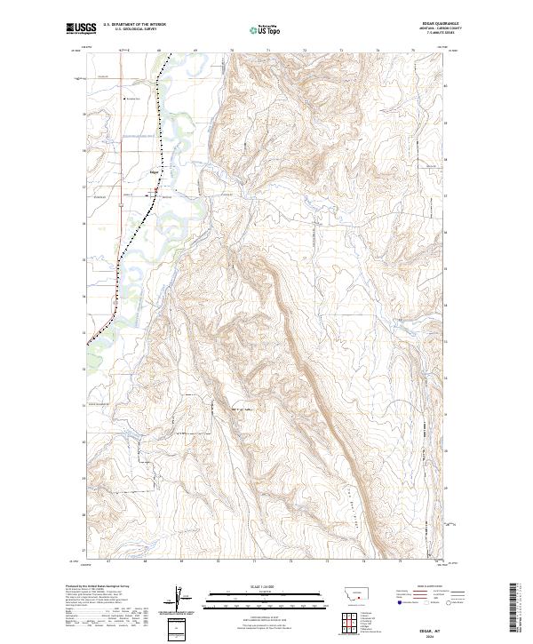
2024 Map of Edgar
USGS Topo · Published 2024About this map
The Clarks Fork Yellowstone River dominates the western edge of this Carbon County landscape, where the small community of Edgar serves as a focal point for the surrounding agricultural district. The map reveals an intricate network of irrigation systems essential to the valley's economy, including the Prosperity-Granite Ditch, Edgar Canal, and Orchard Canal. These man-made waterways contrast sharply with the natural drainage of Fivemile Creek and Two Bear Creek, which flow toward the river from the higher elevations to the east.
Find a feature on this map
25 named features on this map. Tap any name to fly to it.
Don’t see what you’re looking for? This feature index may not catch every label — zoom into the map to look around manually.
Map Details
Editions of this 2024 Edgar Map
This is the sole edition of this map. No revisions or reprints were ever made.
Other maps of this area

1954 · Billings
USGS Topo · 1:250,000

1956 · Bridger
USGS Topo · 1:24,000

1956 · Silesia
USGS Topo · 1:24,000

1956 · Fromberg
USGS Topo · 1:24,000

1956 · Edgar
USGS Topo · 1:24,000
1956 · Montaqua
USGS Topo · 1:24,000

1957 · Billings
USGS Topo · 1:250,000

1958 · Billings
USGS Topo · 1:250,000

1967 · Section House Draw
USGS Topo · 1:24,000

1967 · Bluewater
USGS Topo · 1:24,000