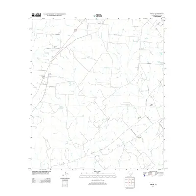
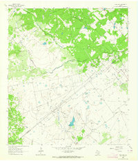
2013 Map of Edgar
USGS Topo · Published 2013About this map
The rural crossing at Edgar and the community of Stratton anchor this survey of DeWitt County's agricultural interior. The landscape is defined by the drainage of Irish Creek and Little Brushy Creek, where numerous small water features such as Bathing Tank and Windmill Tanks reflect the area's cattle-ranching heritage. This 2013 data demonstrates a network of family-named roads and rural infrastructure, including Primitive Bapt Church Rd, which leads toward the Alexander Cem. Genealogical value is found in several scattered burial grounds like Evergreen Cem and Leesville Cem, which sit alongside historic routes like Old Cuero Rd and Old Yoakum Rd. The terrain is characterized by broad creek valleys and subtle depressions such as Petty Hollow, showing the land use patterns of South Texas ranching country.
Find a feature on this map
48 named features on this map. Tap any name to fly to it.
Don’t see what you’re looking for? This feature index may not catch every label — zoom into the map to look around manually.
Map Details
Editions of this 2013 Edgar Map
This is the sole edition of this map. No revisions or reprints were ever made.
Other maps of this area

1953 · Seguin
USGS Topo · 1:250,000

1958 · Seguin
USGS Topo · 1:250,000
1959 · Hochheim
USGS Topo · 1:24,000
1960 · Cuero
USGS Topo · 1:24,000
1960 · Concrete
USGS Topo · 1:24,000
1962 · Verhelle
USGS Topo · 1:24,000
1962 · Edgar
USGS Topo · 1:24,000
1962 · Terryville
USGS Topo · 1:24,000
1963 · Yoakum
USGS Topo · 1:24,000
1963 · Fordtran
USGS Topo · 1:24,000