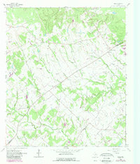
1962 Map of Edge
USGS Topo · Published 1989About this map
Edge serves as a central point of settlement in this part of the Brazos Valley, where the Robertson Co Brazos Co boundary line divides the landscape. This 1962 survey, updated with photo-revisions from the 1980s, reveals a rural community anchored by small family and community burial grounds, such as Edge Cem, Concord Cem, and Shiloh Cem. The terrain is defined by the winding course of Little Cedar Creek and its many tributaries, including Bee Branch and Parker Branch. Traces of the region's historic transit routes are visible in the path of the Kings Highway and the Hickory Grove Road. Notable social and civic gathering places like the Concord Center and Community Center suggest a landscape where rural life was organized around school and church districts. Named rural properties like the Cavitt Ranch reflect the area's agricultural heritage, while various flowing wells and springs indicate the importance of local groundwater for these upland settlements.
Find a feature on this map
35 named features on this map. Tap any name to fly to it.
Don’t see what you’re looking for? This feature index may not catch every label — zoom into the map to look around manually.
Map Details
Editions of this 1962 Edge Map
2 editions found
Other maps of this area

1925 · Iola No 2
USGS Topo · 1:48,000

1925 · Marquez No. 4
USGS Topo · 1:48,000

1927 · Marquez
USGS Topo · 1:62,500

1930 · Marquez
USGS Topo · 1:62,500

1931 · Iola
USGS Topo · 1:62,500

1954 · Waco
USGS Topo · 1:250,000

1954 · Austin
USGS Topo · 1:250,000

1955 · Waco
USGS Topo · 1:250,000

1959 · Clear Lake
USGS Topo · 1:24,000

1962 · Edge
USGS Topo · 1:24,000