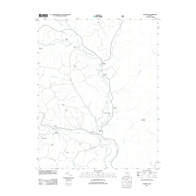
2012 Map of Edgehill
USGS Topo · Published 2012About this map
Middle Fork Black River anchors this drainage basin in Reynolds County, where the Ozark landscape is defined by its series of family-named cemeteries and narrow hollows. The small settlements of Edgehill and Black serve as the primary hubs for a network of rural roads, including the Karkaghne Scenic Dr. The area's genealogy is preserved through numerous burial grounds such as Goggins Cemetery, Troutman Cemetery, and Carty Cemetery, which are scattered among the ridges and valleys. Prominent terrain features like Goggins Mountain and Goggins Hollow reflect the early settling families of this region. The water system is intricate, with numerous tributaries like Little Brushy Creek and Stroher Creek feeding into the river, illustrating the historical reliance on these waterways for both boundary marking and early mountain homesteading.
Find a feature on this map
27 named features on this map. Tap any name to fly to it.
Don’t see what you’re looking for? This feature index may not catch every label — zoom into the map to look around manually.
Map Details
Editions of this 2012 Edgehill Map
This is the sole edition of this map. No revisions or reprints were ever made.
Other maps of this area

1924 · Edgehill
USGS Topo · 1:62,500

1926 · Edgehill
USGS Topo · 1:62,500

1943 · Lesterville
USGS Topo · 1:62,500

1943 · Boss
USGS Topo · 1:62,500

1944 · Corridon
USGS Topo · 1:62,500

1946 · Lesterville
USGS Topo · 1:62,500

1946 · Boss
USGS Topo · 1:62,500

1947 · Corridon
USGS Topo · 1:62,500

1949 · Rolla
USGS Topo · 1:250,000

1953 · Rolla
USGS Topo · 1:250,000