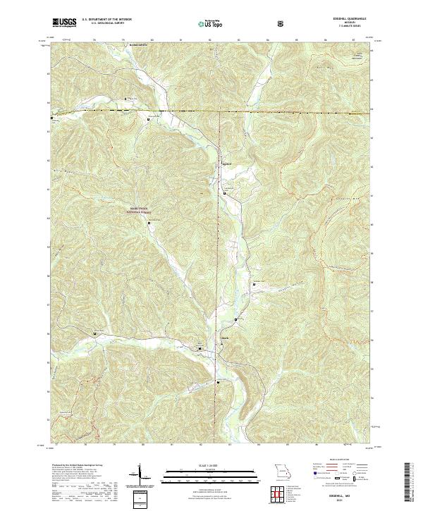
2021 Map of Edgehill
USGS Topo · Published 2021About this map
The Middle Fork Black River carves a deep valley through the Saint Francois Mountains in this modern survey of the Mark Twain National Forest. The landscape is defined by its network of hollows, including Goggins Hollow and Peter Cave Hollow, which drain into the river's winding course. This area of Reynolds County is dotted with several family-named burial grounds that speak to the long-standing settlement history of the region, such as Goggins Cem and Shy Cem. The map highlights the rugged topography of peaks like Bell Mtn and Goggins Mtn, alongside the small communities of Black, Edgehill, and Redmondville. A significant feature for recreation and transit is the Ozark Trl, which meanders across the ridges, following the natural contours of the high ground between Clayton Cr and Walker Br.
Find a feature on this map
50 named features on this map. Tap any name to fly to it.
Don’t see what you’re looking for? This feature index may not catch every label — zoom into the map to look around manually.
Map Details
Editions of this 2021 Edgehill Map
This is the sole edition of this map. No revisions or reprints were ever made.
Other maps of this area

1924 · Edgehill
USGS Topo · 1:62,500

1926 · Edgehill
USGS Topo · 1:62,500

1943 · Lesterville
USGS Topo · 1:62,500

1943 · Boss
USGS Topo · 1:62,500

1944 · Corridon
USGS Topo · 1:62,500

1946 · Lesterville
USGS Topo · 1:62,500

1946 · Boss
USGS Topo · 1:62,500

1947 · Corridon
USGS Topo · 1:62,500

1949 · Rolla
USGS Topo · 1:250,000

1953 · Rolla
USGS Topo · 1:250,000