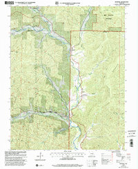
1999 Map of Edgehill
USGS Topo · Published 2002About this map
The Middle Fork Black River carves through this portion of the Mark Twain National Forest, defining the settlement patterns of the Ozark highlands at the end of the millennium. Small communities like Edgehill, Black, and Redmondville follow the river valley, which serves as the primary corridor for movement and agriculture. The landscape is characterized by its numerous family and community burial grounds, including Black River Cem, Goggins Cem, and Strickland Cem, reflecting a deep ancestral connection to the hollows and ridges.
Find a feature on this map
36 named features on this map. Tap any name to fly to it.
Don’t see what you’re looking for? This feature index may not catch every label — zoom into the map to look around manually.
Map Details
Editions of this 1999 Edgehill Map
This is the sole edition of this map. No revisions or reprints were ever made.
Other maps of this area

1924 · Edgehill
USGS Topo · 1:62,500

1926 · Edgehill
USGS Topo · 1:62,500

1943 · Lesterville
USGS Topo · 1:62,500

1943 · Boss
USGS Topo · 1:62,500

1944 · Corridon
USGS Topo · 1:62,500

1946 · Lesterville
USGS Topo · 1:62,500

1946 · Boss
USGS Topo · 1:62,500

1947 · Corridon
USGS Topo · 1:62,500

1949 · Rolla
USGS Topo · 1:250,000

1953 · Rolla
USGS Topo · 1:250,000